
Fichier:Three Gorges Dam, China.jpg

Kiɖe tɛɛ takayaɣ (Kpaɣna pɩkɩsɛlɩ 3 072 nɛ pɩtalɩ 2 039 ñɩŋgʋ, takayaɣ walanzɩ : 1,42 Mio, MIME akɩlɩ : image/jpeg)
Kɛdɩtʋ
| Kɛdɩtʋ |
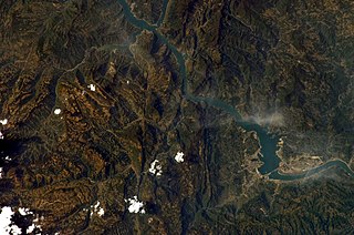
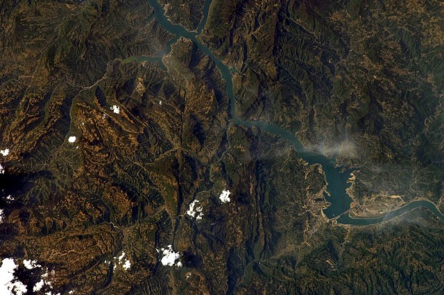
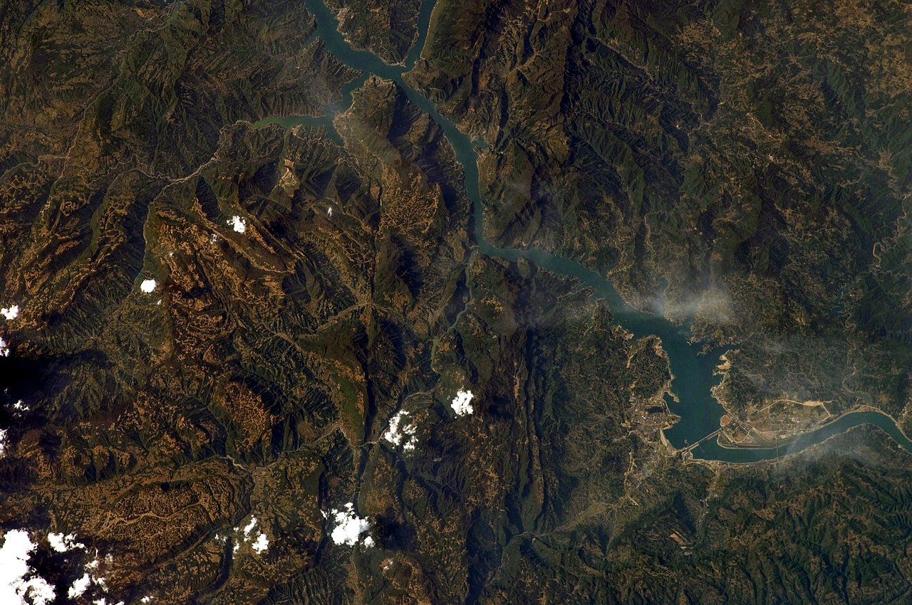
English: This image captures the flooding behind the Three Gorges Dam (north is up).
This photograph was acquired with a Nikon 2DXs digital camera fitted with a 180 mm lens, and is provided by the ISS Crew Earth Observations experiment and Image Science & Analysis Laboratory, Johnson Space Centre. Instrument: ISS - Digital Camera
|
||||||||||||||||||||||||||||||||||||||||||||||||||||||
| Efemiye | |||||||||||||||||||||||||||||||||||||||||||||||||||||||
| Kiɖe | NASA Earth Observatory | ||||||||||||||||||||||||||||||||||||||||||||||||||||||
| Mayʋ | This image was taken by the NASA Expedition 19 crew. | ||||||||||||||||||||||||||||||||||||||||||||||||||||||
| Autres versions | File:Three Gorges Dam on the Yangtze River.jpg | ||||||||||||||||||||||||||||||||||||||||||||||||||||||
| Lieu de la prise de vue | | Voir cet endroit et d’autres images sur : OpenStreetMap |
|---|
Cette image ou vidéo a été cataloguée par le Johnson Space Center de la National Aeronautics and Space Administration (NASA) des États-Unis sous Photo ID : ISS019-E-7720.Ce bandeau n’indique rien sur le statut de l’œuvre au regard du droit d'auteur. Un bandeau de droit d’auteur est requis. Voir Commons:À propos des licences pour plus d’informations. Autres langues :
|
Labɩnaʋ paɣtʋ
| Ce fichier provient de la NASA. Sauf exception, les documents créés par la NASA ne sont pas soumis à copyright. Pour plus d'informations, voir la politique de copyright de la NASA. | ||
 |
Attention :
|
Takayaɣ caanaʋ tɔm kɛdʋʋ
Tukina efemiye nɛ ñɩɣtʋ nɛ ŋna takayaɣ kanɛ ɛzɩ kaawɛʋ alɩwaatʋ ndʋ tɩ-taa yɔ.
| Efemiye nɛ ñɩɣtʋ | Tampɔɔ | Walanzɩ | Labɩnayʋ | Tɔm taa nuutuu | |
|---|---|---|---|---|---|
| lɛlɛɛyɔ | 30 Salaŋ fenaɣ 2010 à 09:08 | | 3 072 × 2 039 (1,42 Mio) | Originalwana | rotated |
| 5 Mɩsɩkʋm fenaɣ 2010 à 09:19 |  | 3 072 × 2 039 (3,36 Mio) | Originalwana | higher res | |
| 8 Mɩsɩkʋm fenaɣ 2009 à 09:42 |  | 1 440 × 1 080 (636 kio) | Originalwana | {{Information |Description={{en|1=This image captures the flooding behind the Three Gorges Dam.}} |Source=http://earthobservatory.nasa.gov/IOTD/view.php?id=38879&src=iotdrss |Author=This image was taken by the NASA Expedition 19 crew. |Date=2009-04-15 |Pe |
Takayaɣ labɩnaʋ
Takayɩhayʋʋ kɩtɩŋʋʋ lakɩna takayaɣ kanɛ tʋmɩyɛ :
takayaɣ labɩnaʋ nɛ paa anɩ
Wikinaa kɩtɩŋaa lɛlaa lakɩna kɩlɛmʋʋ kʋnɛ nɛ tʋmɩyɛ :
- Labɩnaʋ bo.wikipedia.org yɔɔ
- Labɩnaʋ ms.wikipedia.org yɔɔ
- Labɩnaʋ pl.wikipedia.org yɔɔ
- Labɩnaʋ pnb.wikipedia.org yɔɔ