
Fichier:Illinois Locator Map with US.PNG
Tʋtʋ tʋnɛ tɩ-wayɩ fɛyɩ.
Illinois_Locator_Map_with_US.PNG (Kpaɣna pɩkɩsɛlɩ 288 nɛ pɩtalɩ 405 ñɩŋgʋ, takayaɣ walanzɩ : 13 kio, MIME akɩlɩ : image/png)
Kɛdɩtʋ

|
Cette image (de type locator map) devrait être recréée dans un format vectoriel, en tant que fichier SVG. Cela offrirait plusieurs avantages : voir Commons:Media for cleanup pour plus d'informations. Si une version SVG de cette image est déjà disponible, merci de bien vouloir l'envoyer. Après cela, remplacez ce modèle par {{vector version available|nouveau nom d'image.svg}}.
|
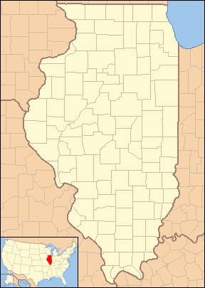
| Kɛdɩtʋ | Locator Map of Illinois, United States |
| Efemiye | |
| Kiɖe | taken from US Census website [1] and modified by User:VerruckteDan, User:Ruhrfisch, User:Huebi, and User:Appraiser |
| Mayʋ | US Census, User:VerruckteDan, User:Ruhrfisch, User:Huebi, and User:Appraiser |
| Waɖɛ haʋ (Ɖaɣnʋʋ labɩnaʋ takayaɣ kanɛ) |
US Census / US Government work is public domain, my modifications licensed under the GNU Free Documentation License |
Labɩnaʋ paɣtʋ

|
Paha-ŋ waɖɛ se ŋlɩzɩ takayaɣ kanɛ kɛ-lɛzʋʋ nɛ ŋtɛyɩ-kɛ nɛ ŋñɔɔzɩ-kɛ, pɩlɩɩna GNU Free Documentation License ñɔɔzɩtʋ kɩlɛɣzɩtʋ 1.2, yaa paa ñɔɔzɩtʋ kɩlɛɣzɩtʋ Free Software Foundation kosusaa kpaɣ nɛ ɖooo wayɩ ñɩndʋ yɔ. Ɛlɛ, hɔɔlɩŋ weyi paapɩzɩɣ pɛlɛɣzɩ yɔ, nɛ kajalaɣ takayɩhayʋʋ yɔɔ tɔm, nɛ kpaagbaa ñɩŋgʋ yɔɔ ñɩndʋ pɛfɛyɩ pɩ-taa. Waɖɛ haʋ tɔm wɛ hɔɔlʋʋ ŋgʋ paya-kʋ se GNU Free Documentation License yɔ kɩ-taa. |
| Ŋpɩzɩɣ ŋna takayaɣ kanɛ ka-waɖɛ haʋ cɩnɛ : Creative Commons paternité ‚Äì partage à l'identique 3.0 (non transposée). | ||
| Tɩɣyɩtʋ: We, Ruhrfisch and Appraiser | ||
| ||
| Ce bandeau de licence a été ajouté à ce fichier dans le cadre de la procédure de mise à jour des licences des images sous GFDL. |
Ce fichier est disponible selon les termes de la licence Creative Commons Attribution – Partage dans les Mêmes Conditions 2.5 Générique
- Ŋwɛ ña-tɩ yɔɔ
- tɛyʋʋ – tʋmɩyɛ kɩlabɩyɛ ɖɩnɛ ɖɩ-kɩlɛmʋʋ kpaɣʋ; tʋmɩyɛ kɩlabɩyɛ ɖɩnɛ ɖɩ-tɛyʋʋ ; tʋmɩyɛ kɩlabɩyɛ ɖɩnɛ ɖi-yekinaʋ
- siduu – tʋmɩyɛ kɩlabɩyɛ malɩsnaʋ
- Pɩtɩŋna paɣtʋ ndʋ tɩ-wɛ pɩ-tɛɛ yɔ tɩ-yɔɔ :
- Tɩɣyɩtʋ – Pʋwɛɛ se ŋyaa kiɖe tɛɛ takayaɣ mayʋ hɩɖɛ ɛzɩ mayʋ wɩlʋʋ yɔ yaa waɖɛ yɔɔ ɖoŋ wɛnayʋ weyi ɛhaɣ-ŋ waɖɛ nɖɩ yɔ (ɛlɛ, pɩtaawɛɛ ɛzɩ ɛtɩnɩɣ ñɔ-yɔɔ kanɛ yɔ yaa ɛzɩ etisaa se ŋlabɩna takayaɣ nɛ tʋmɩyɛ yɔ).
- Tɛyɩ mbʋ pɩlɩ ɖama yɔ – Yee ŋñɔɔzaa yaa ŋlɛɣzaa yaa ŋñɩɣ takayaɣ kanɛ kɔ- yɔɔ, pʋwɛɛ se ŋtɛyɩ ña-takayaɣ kɩñɔɔzaɣ waɖɛ haʋ kʋɖʋmbʋ mbʋ pʋ-yɔɔ yaa waɖɛ haʋ mbʋ pʋwɛ ɛzɩ pʋnɛ yɔ.
Ŋpɩzɩɣ ŋlɩzɩ waɖɛ haʋ pʋnɛ pɩ-taa kʋɖʋmbʋ.
and
This image or file is a work of a United States Census Bureau employee, taken or made as part of that person's official duties. As a work of the U.S. federal government, the image is in the public domain.
|
 |
Takayaɣ caanaʋ tɔm kɛdʋʋ
Tukina efemiye nɛ ñɩɣtʋ nɛ ŋna takayaɣ kanɛ ɛzɩ kaawɛʋ alɩwaatʋ ndʋ tɩ-taa yɔ.
| Efemiye nɛ ñɩɣtʋ | Tampɔɔ | Walanzɩ | Labɩnayʋ | Tɔm taa nuutuu | |
|---|---|---|---|---|---|
| lɛlɛɛyɔ | 24 Mɩsɩkʋm fenaɣ 2013 à 12:16 | | 288 × 405 (13 kio) | Zyxw | Same width & height as File:Illinois Locator Map.PNG for use with mapping templates. Inset is File:Map of USA IL.svg. Smaller file size. |
| 8 Lakɩŋ fenaɣ 2008 à 21:43 |  | 292 × 409 (18 kio) | Appraiser | {{Information| |Description= Locator Map of Illinois, United States |Source= taken from US Census website [http://factfinder.census.gov/] and modified by User:Ruhrfisch, User:Huebi, and User:Appraiser |Date= March 2008 |Author= US Census, [[U | |
| 3 Lakɩŋ fenaɣ 2008 à 03:03 |  | 288 × 405 (17 kio) | Appraiser | {{Information| |Description= Locator Map of Illinois, United States |Source= taken from US Census website [http://factfinder.census.gov/] and modified by User:Appraiser |Date= March 2007 |Author= US Census, Appraiser |Permission= US Census / US Gover |
Takayaɣ labɩnaʋ
Takayɩhayʋʋ kɩtɩŋʋʋ lakɩna takayaɣ kanɛ tʋmɩyɛ :
takayaɣ labɩnaʋ nɛ paa anɩ
Wikinaa kɩtɩŋaa lɛlaa lakɩna kɩlɛmʋʋ kʋnɛ nɛ tʋmɩyɛ :
- Labɩnaʋ ar.wikipedia.org yɔɔ
- Labɩnaʋ be-tarask.wikipedia.org yɔɔ
- Labɩnaʋ ceb.wikipedia.org yɔɔ
- Labɩnaʋ en.wikipedia.org yɔɔ
- Labɩnaʋ es.wikipedia.org yɔɔ
- Labɩnaʋ fa.wikipedia.org yɔɔ
- دلاوان، ایلینوی
- ایست مولین، ایلینوی
- ایست سنت لوئیس، ایلینوی
- ادواردزویل، ایلینوی
- ژنو، ایلینوی
- گرافتون، ایلینوی
- جکسونویل، ایلینوی
- جرزیویل، ایلینوی
- مندوتا، ایلینوی
- مانتیسلو، ایلینوی
- مونتکارمل، ایلینوی
- ناپرویل، ایلینوی
- نائوو، ایلینوی
- اوگلسبی، ایلینوی
- پئوریا، ایلینوی
- پرینستون، ایلینوی
- کوئینسی، ایلینوی
- سنت چارلز، ایلینوی
- تیلور ویل، ایلینوی
- Labɩnaʋ ilo.wikipedia.org yɔɔ
- Labɩnaʋ sh.wikipedia.org yɔɔ
Cɔna takayaɣ labɩnaʋ tɩŋa